This Bachelor thesis was written at Palacky University in Olomouc, the department of Geoinformatics.
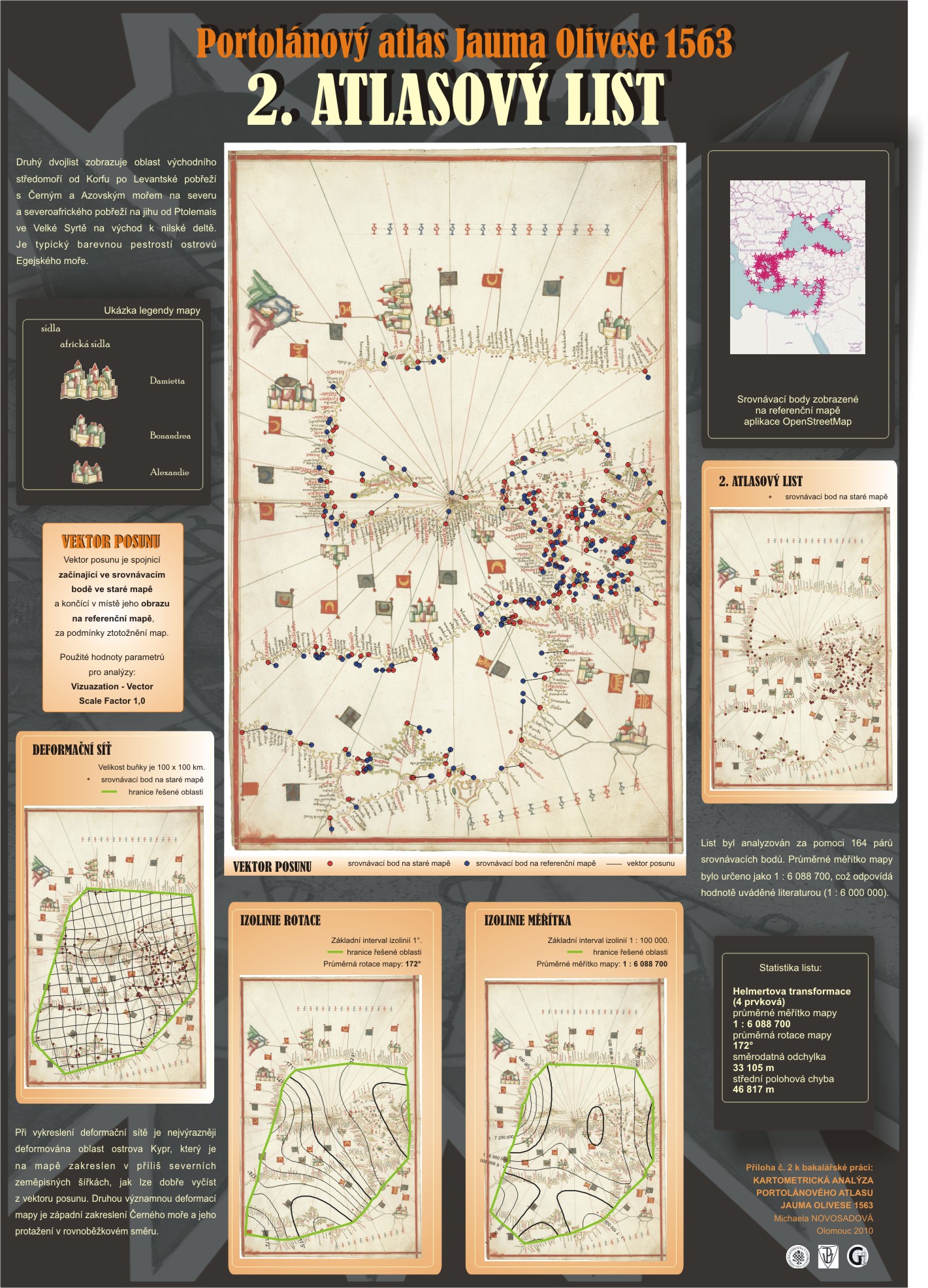
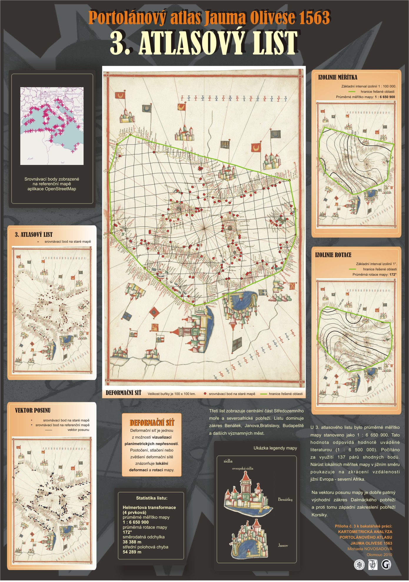
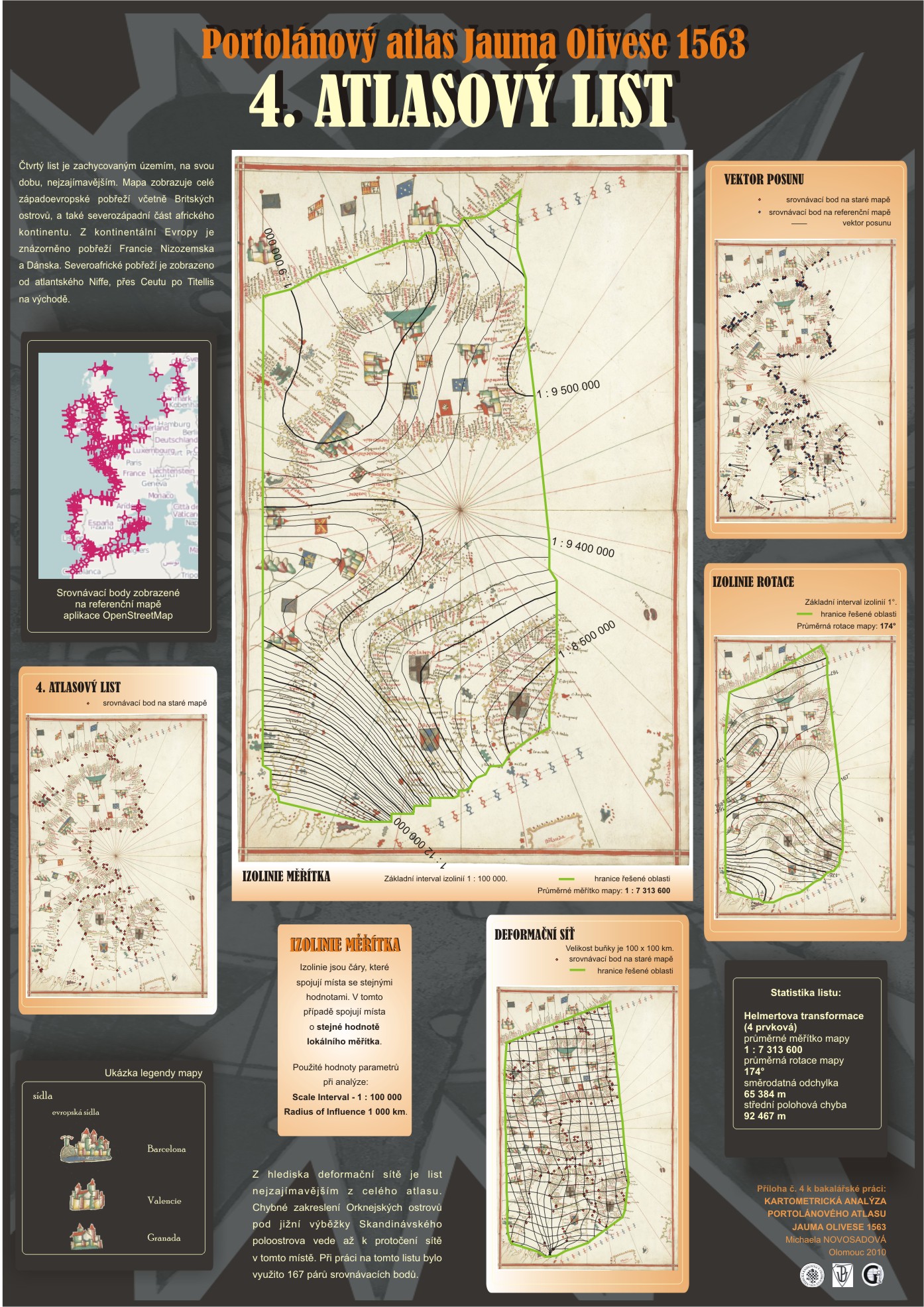
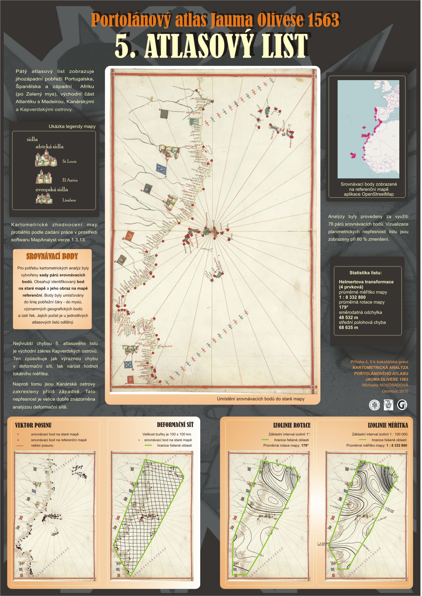
It deals with the visualization features of cartometric historical nautical maps Portolánový Atlas by Jaume Olives in 1563, found in Research Library in Olomouc in 2006. The problem is solved in software MapAnalyst version 1.313.
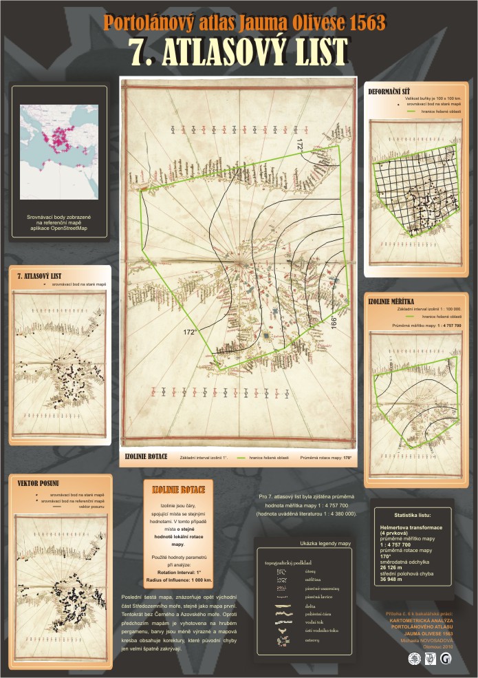
In this thesis, I analyzed five satin sheets deformation distortion grid, displacementvector, isolines scale and isolines rotation metodes.
Another outcome of work are compiled legend satin sheets and inventory records of map descriptions. For those elements of the current search was endonymum and Czech exonym.