INTRODUCTION
INTRODUCTION

Many cities in developed, developing, and under-developed countries face the challenges of meeting the social, environmental, and economic needs of the huge proliferation of global urbanization. Urban settlements continue to witness an abrupt increase in population worldwide due to the migration of people from rural settlements and the rise in the fertility rate. According to the United Nations, the world urban population experienced a speedy growth from 1960 (when it was 1 billion) to 4.4 billion in 2020. Today, 55% of the world's population lives in urban areas and it has been estimated that this figure will increase to 68% by 2050.
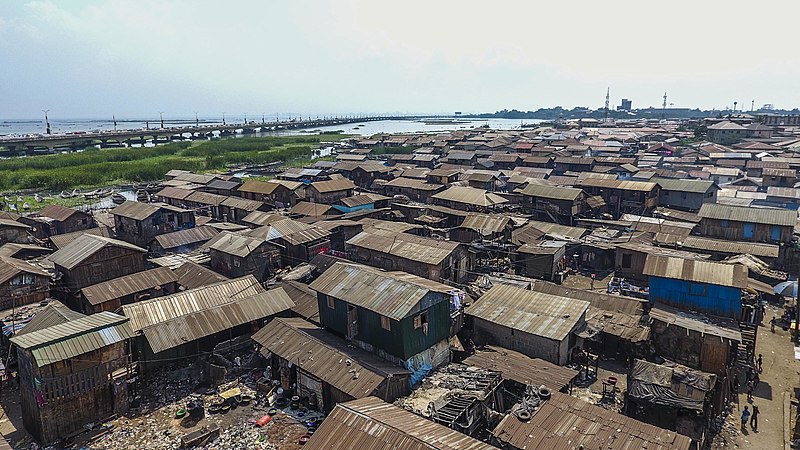
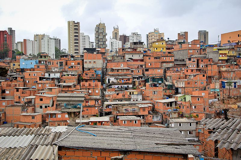
One of the biggest challenges faced with the huge increase in global urbanization is the irrepressible growth of slums. Within the urban population, over 1 billion people live in slums and the proportion of slum dwellers is expected to grow rapidly in the nearest decades. Most of the world’s largest slums are found in megacities, particularly in Africa, Latin America and Asia. Lack of spatial and attribute information about the slums such as slum extents, size, geographic location, number of houses and the population of slum dwellers, etc. hindered planning, development, and proper management of cities, thus deprived the dwellers of some adequate services, infrastructures and amenities for life sustainability. In some cases, the slums are not existing in the master plan of the urban settlements.
However, geospatial technologies bridged the information gap, hence enabling the concerned bodies to make well-informed decisions on improving the living conditions of the slum dwellers. Government agencies, international organizations (such as UN-Habitat etc.), NGOs (such as SDI, LiveInSlums etc.) support slum dwellers through various international cooperation projects and developments programmes. To achieve such projects, it is necessary to gather adequate information about the slums (locations, types etc.) and the dwellers (population density); hence geoinformation technology is pertinent.
This research tends to map and monitor slums from imagery using different algorithms and then select the best-performed algorithm with optimal result. It was observed that within the significant number of researches carried out on slum mapping and monitoring using Geographic Information (GI), very few demonstrated different spatial algorithms, this is the main motivation for this study.


