Methodology
General description
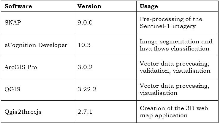
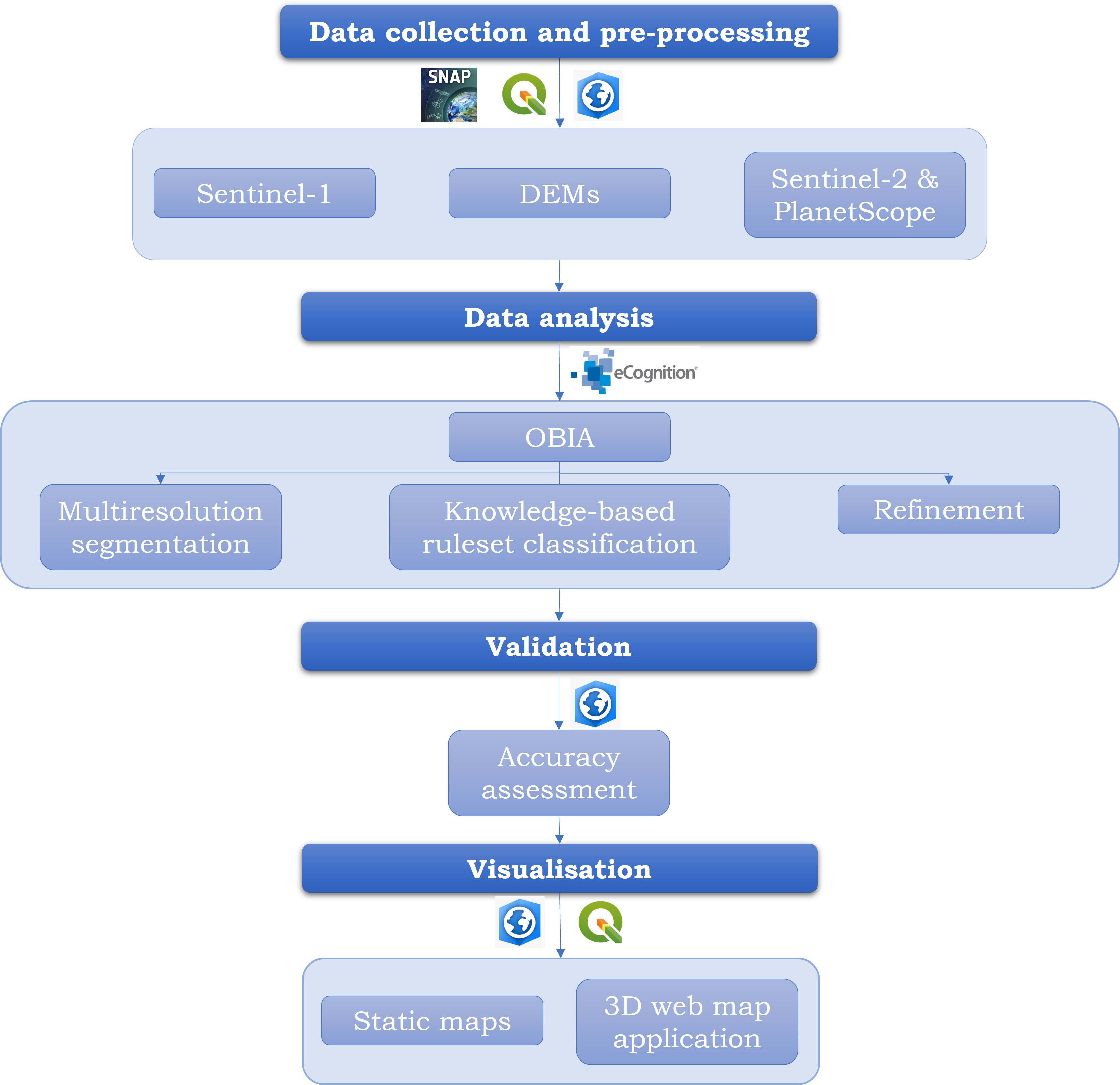
EO data have been useful for lava flow mapping and analysis when applying different remote sensing methodologies. OBIA is among one of the techniques used for geomorphological mapping of volcanic areas, and it has been combined with several types of datasets for the same purpose. Cartography allows the modelling of reality through graphical representations of the spatial dimension of the world; therefore, it is one of the most effective ways to communicate spatial information. This study develops two main research: the first one is the delineation of lava flows from the 2021 Fagradalsfjall eruption using OBIA on Sentinel-1 data, and the second one is the visualisation of the results using cartographic products. The general workflow is shown in the image below. The following table summarises the used software with the corresponding version and usage.
Used software
The following table summarises the used software with the corresponding version and usage.