Methodology
An overview of the procedures and methods used
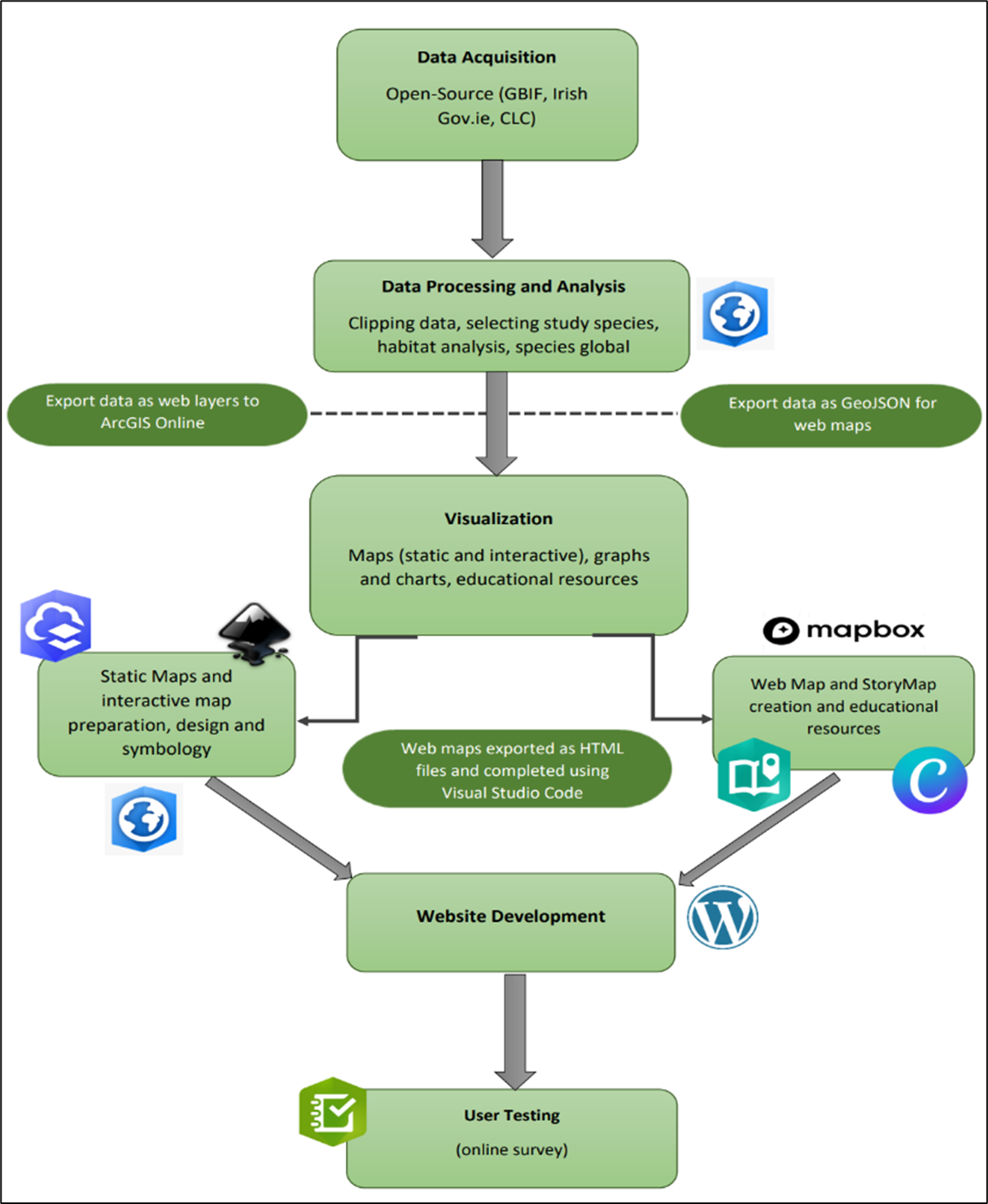
Procedure
(a) Collect and analyse open-source biodiversity data for twenty study species with recorded observations in Glenveagh National Park
(b) Use the processed biodiversity data combined with landcover and geology data to conduct a brief habitat analysis to produce a series of interactive and static maps;
(c) use WordPress to develop and publish an easily accessible, open-source platform that is openly available to the public; particular attention is given to the design and geovisualization which is used to not only enhance the appearance but the usability and interactivity of the platform
(d) develop a series of educational activities and additional resources available online and as downloadable pdfs relating to local flora and fauna and their surrounding landscapes
(e) Conduct user testing to gain feedback on geovisualizations and if they aided in locating and retaining spatial information
Data Used
Corine Land Cover (2018), Glenveagh National Park Shapefile (Data.Gov.ie, 2022), species observation data (GBIF, 2022), bedrock geology shapefile 1:100,000 (Data.Gov.ie, 2022)
Software and Platforms Used
ArcGIS Pro (2.9), ArcGIS Online, Esri StoryMaps, Canva, Inkskape Project (1.1), Mapbox, Microsoft Excel (MS Office 365), Esri's Survey123, WordPress, Visual Code Studio
Methods Used
Habitat analysis, species distribution analysis, geovisualization Geovisualization