Methodology
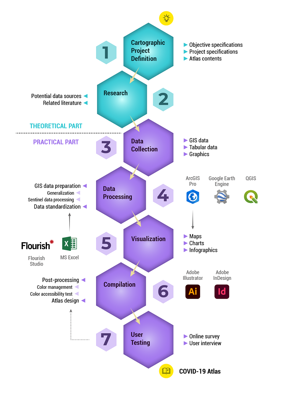
For the completion of this master’s thesis, the initial work was focused on the theoretical part starting with the cartographic project definition. The objective and project specifications were identified and the contents of the atlas were finalized following a consultation with the thesis supervisor. This was followed by preliminary research on the potential data sources as well as on scientific literature about the topic. Important issues focusing on thematic cartography and map design were explored together with the state of atlas creation specifically on global topics.
Due to the broad range of topics included in the atlas, a great deal of time was devoted to data collection and processing. The initial part of data collection was spent on the acquisition of GIS data for the reference map and the environmental topics especially since the datasets for the other topics were still unavailable until the end of January 2021. Once all the necessary datasets were obtained, data processing and harmonization using GIS software were conducted before the actual production of maps and other graphical contents of the atlas.
Map and chart design improvements (e.g. color management, color standardization, etc.) and the designing of the final atlas layout were accomplished using desktop publishing programs (DTP). A short user testing was also performed after the creation of the final atlas to evaluate the usability of the generated cartographic product. Several consultations regarding the map design were conducted together with the thesis supervisors to ensure that the final product will maximize its usability.
Workflow Diagram