Summary
The master thesis Advance Analysis of Visibility was processed at the Department of Geoinformatics at the Faculty of Science at Palacký University in Olomouc. Supervisor was Mgr. Jana Svodobová, Ph.D. The main goal of the thesis was to create a procedure that would allow finding routes with the best or worst view to the surroundings. Another main goal was evaluation of the current routes such as hiking trails, biking routes or road network.
There are several methods for calculating routes with the best or worst view to the surroundings. Procedure of D. R. Caldwell from the University of Edinburgh was chosen as a model approach. This approach didn’t engage only calculation of the most and least visible path (which are similar to routes with best or worst view to the surroundings) but they also made various characteristics of the test area. This procedure was modified into a form that was feasible in the Department of Geoinformatics.
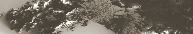
First part of the work was applied at island Mallorca and its close surroundings. As a source elevation data was taken Shuttle Radar Topography Mission 90 m raster. First step was to calculate cumulative visibility raster which is sum of viewsheds from each grid point of the test area. This calculation lasted over 1800 hours. Two versions of this raster were calculated. First one included pixels of the sea. Another one reflected only dry land. The differences were significant and conclusion of this is that sea cannot be excluded. Even though it isn’t dry land it is still observable.
Furthermore, several analyzes that were described in Caldwell’s procedure were accomplished. They helped to characterize the area and determine its specifications. Calculation of the least and most visible path was the most important analysis. The cumulative visibility raster entered this analysis as a cost raster. Raster of roads can be added so current roads will be favoured. Naturally, another cost raster can be added.
Second part of this work evaluated current routes in terms of visibility. As a test area surrounding of Lysá hora mountain was chosen. More detailed digital elevation model was created with spatial dimension of 20 m. Two digital elevation models were created. First one, the so-called “bare”, with no vegetation or buildings. Second one with supplied information about the forest high and block built-up area. This was done to examine the differences and evaluate the effect of vegetation on visibility analysis.
Several hiking trails and biking trails were chosen to evaluate them. They were divided into twenty sections, in order to evaluate them in shorter parts. Subsequently, all sections were evaluated in terms of view with both elevation grids entering the calculation. The differences between both elevation grids were evaluated. For each section the viewshed was created and published on this website on page “Výstupy” and on DVD which is attached to this master thesis.
For this area of interest a list of 209 points of interest was created. Individual sections were evaluated with respect to these points. As a result, we can say from which section each point is the best visible and which way to go to have the best view on specific point of interest.
This master thesis has shown that analysis of visibility can be used to much wider range of analyzes than they are used now. Analysis of visibility doesn’t have great potential only in traditional areas, in which are already being used, but also in the areas where they start to get through, such as tourism.